Early Warning System
A web map that shows where and when climate and environmental conditions favour key pests and diseases, so farmers and advisers can act before an outbreak spreads.
- 3threats monitored
- 2languages: French and English
- Autoupdates itself as new data arrives
- 2024pilot completed in June, public from July
The Early Warning System map
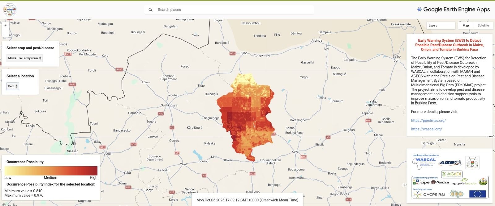
Choose a crop on the map to see the occurrence probability across Burkina Faso.
The map not loading? Open it in a new tab · Close the map
Three threats, one map
The pilot Early Warning System (PEWS) predicts how likely conditions are to favour one pest or disease for each crop. Users choose a crop and see the occurrence probability across Burkina Faso.
When conditions are favourable, farmers and extension officers can plan targeted checks and interventions instead of reacting after damage is done.
Maize: fall armyworm
A destructive pest that can destroy whole fields.
Onion: defoliating caterpillars
Caterpillars that strip the leaves.
Tomato: bacterial wilt
A disease that causes plants to wilt and die.
The map
How the predictions are made
- Find what drives outbreaksThe team reviewed scientific literature on climate and environmental factors affecting pests and diseases, and selected variables available in Google Earth Engine.
- Link conditions to real outbreaksClimate and environmental values were extracted at the locations of pests and diseases recorded by extension officers.
- Pick the most influential factorsPrincipal Component Analysis identified the most influential variables, and the Analytic Hierarchy Process weighted them.
- Compute occurrence probabilityA weighted combination produces an occurrence probability index shown on the map.
- Keep it currentThe system runs on Google Earth Engine, so it updates automatically as new data enters the catalogue.
Managed by the Ministry, supported by WASCAL
Ministry of Agriculture
Manages the system to provide advisory information to farmers through extension officers.
Extension officers
Use the maps to plan advice and field visits.
Researchers
Use the outbreak probability maps for research and planning.
The system needs an internet connection and nothing has to be installed. From its public launch in July 2024 to 22 January 2025, the map had 342 visitors. As a pilot, it does not yet cover every pest and disease, and more statistics for pest and disease management planning are still to be developed.